
1643
Abel Tasman sights Fiji, 1643
What we know
- The Dutch navigator Abel Tasman, with the ships Heemskerck and Zeehaen, sighted islands in north-east Fiji in 1643.
- He passed through dangerous reefs and did not land.
Pictures in this chapter
 Map of Abel Tasman's voyages
 Early Dutch map of the lands found on Tasman's voyages — State Library of New South Wales
 Woodcut by Isaack Gilsemans from Abel Tasman's journal, 1642–43
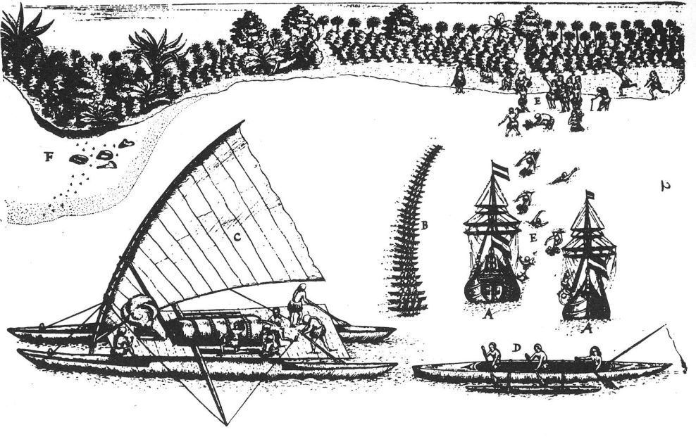 Woodcut by Gilsemans (?) from ship diary by Abel Tasman , showing both ships in the bay (A), the inhabitants of Tongatapu with presents (B and E), showing their cano (C), how they fish (D), and where
 Portrait of Abel Tasman, his wife and daughter
 A view of the Murderers' Bay, as you are at anchor here in 15 fathom (text upper left). (1642)
 Chart of the north-west coast of the South Island, New Zealand, Huijdecoper journal of Abel Tasman, Hessel Gerritsz, 1643, drawing, State Library of New South Wales, Safe 1/72
 Coastal drawings of Tasmania, Huijdecoper journal of Abel Tasman, Hessel Gerritsz, December 1642, drawing, State Library of New South Wales, Safe 1/72
 Abel Janssen Tasman, Navigateur en Australie. (1850)
 Tracing of a chart from Abel Tasman's voyages
Sources
More in Explorers
Tell the museum something
A memory, a correction, or a question. Nothing you send appears on the site. It goes to the museum’s own queue, a person reads it, and they decide. If you teach, know this place, or remember it, your correction is worth more than a compliment.
This chapter’s text is awaiting cultural and historical review. Pictures keep the credit and licence of the collection that holds them.