
Charles Chowe Howard, of Rotuma
Rotuma · 1881 · picture 2 of 11 in this chapter
- Credit
- Unknown author · Public domain
- Licence
- Public domain
- Chapter
- Read “Rotuma” → · Walk into it in the 360° museum →
- Source record
- View the original record ↗
- The file
- Open the full-size picture ↗ — Public domain; reuse it under those terms and keep the credit.
More from “Rotuma”
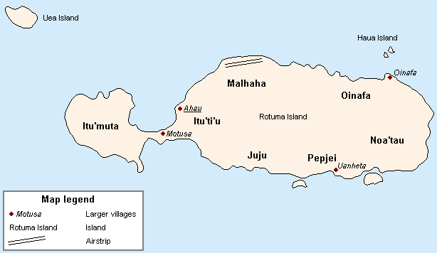 Map of Rotuma
 Photo of MMofmanu Beach, Rotuma (2008)
 Council of Chiefs of Rotuma, 1927
 Satellite image of Rotuma
 Map of Rotuma, north of Fiji, Melanesia, Pacific Ocean, showing district boundaries, appeared in Australian Science Journal, 1895
 Two men by a tomb on Rotuma (about 1865) — Rijksmuseum
 map of Rotuma, Fiji, Pacific Ocean (1898)
 A man on Rotuma — KITLV collection
 Admiralty Chart No 2992 Rotumah Island, Published 1897
 Chief of Rotuma, drawn by Alfred Thomas Agate of the US Exploring Expedition
Tell the museum something
A memory, a correction, or a question. Nothing you send appears on the site. It goes to the museum’s own queue, a person reads it, and they decide. If you teach, know this place, or remember it, your correction is worth more than a compliment.
This picture is shown with the credit and licence given by the collection that holds it; the museum claims no rights over it. Where the museum also holds an enhanced interpretation of this picture, it appears only inside the chapter, beside the original, and is labelled as speculative.